
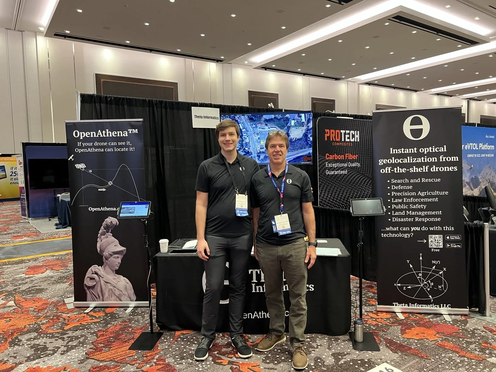
Theta Informatics will begin accepting direct retail orders for its software-only drone geolocation application at Booth # 1133 in Las Vegas, with both editions offered at $99 per annual license.
ATLANTA, Ga. — August 27, 2026 — Theta Informatics LLC today announced that it will make the world retail debut of OpenAthena™ Desktop U.S. and OpenAthena™ Desktop CIV at Commercial UAV Expo 2026. The event will be held September 1–3 at Caesars Forum in Las Vegas, Nevada. Attendees can visit Theta Informatics at Booth #1133 for live demonstrations, product consultations, and the first opportunity to purchase the new retail editions directly from Theta.
The retail launch represents an important transition for the OpenAthena program. Following more than six years of research and development and earlier releases to select partners and end users, Theta is making the full OpenAthena Desktop application available under a streamlined annual retail license for commercial operators, public-safety organizations, government agencies, researchers, and other professional users.
Both OpenAthena Desktop U.S. and OpenAthena Desktop CIV will be offered at a show and launch week exclusive retail price of $99 per annual license.
From a Single Pixel to Usable Ground Coordinates
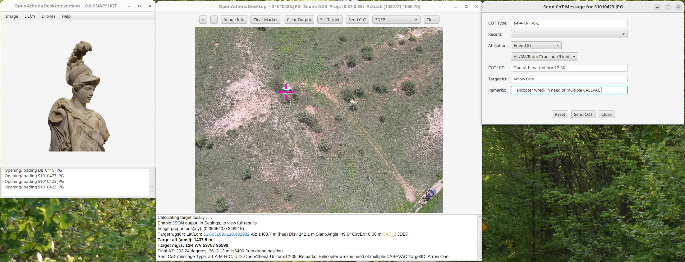
OpenAthena Desktop allows an operator to select any visible point within a compatible drone image and rapidly calculate its latitude, longitude, and elevation. The software combines the drone camera’s recorded position and orientation, calibrated camera and lens characteristics, and digital terrain model data to trace a software-generated ray from the selected image pixel to its intersection with the ground.
This terrain-raycast process provides a software-only passive ranging capability using the cameras, sensors, and metadata already present on many commercial off-the-shelf drones. It can therefore add useful geolocation capability without requiring the operator to purchase, install, or integrate a separate laser rangefinder payload. Unlike methods that require a collection of overlapping images followed by photogrammetric processing, OpenAthena can calculate a location from one pixel in one still image.
The software is designed for time-sensitive and location-dependent applications including:
- Search and rescue;
- Fire and emergency response;
- Public safety and law enforcement;
- Disaster assessment and recovery;
- Land and natural-resource management;
- Environmental monitoring;
- Infrastructure inspection;
- Private security;
- Commercial drone services; and
- Authorized U.S. defense applications.
OpenAthena Desktop is intended to help operators turn drone imagery into actionable location information more quickly while continuing to use their existing aircraft and camera hardware.
Designed for Connected and Offline Operations
OpenAthena Desktop includes a graphical workflow for loading drone images, selecting objects or terrain features, reviewing image metadata, calculating ground coordinates, and sharing the resulting position-location information.
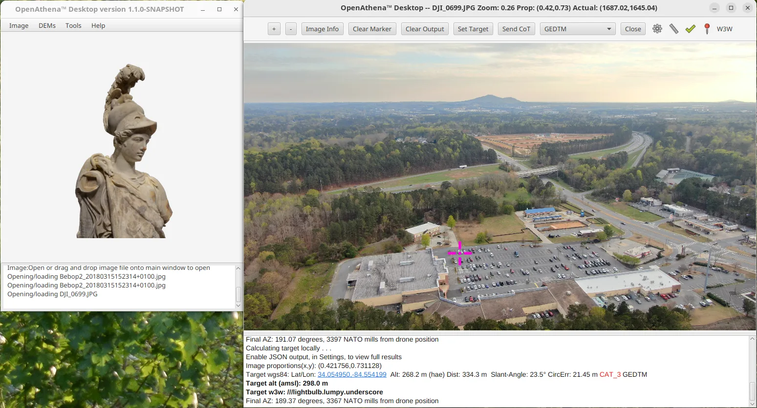
Current capabilities include:
- Ground-coordinate calculations in less than eight milliseconds when required terrain data is locally available;
- Selection and geolocation of off-center pixels anywhere within the supported camera’s field of view;
- Built-in calibration data for more than 60 color and infrared drone-camera makes and models;
- Support for multiple coordinate-reference systems;
- Automatic downloading and management of digital elevation model data;
- Bulk terrain-data downloading for later offline use;
- Uses specialized digital terrain model (DTM) datasets which model bare terrain height rather than treetop/buildingtop height, providing significantly better accuracy than typical SRTM/DTED DSM data.
- Continued operation even offline and under denied, degraded, intermittent, or low-bandwidth (DDIL) network conditions;
- Export of multiple calculated locations to KML for use with QGIS, ArcGIS, and other geospatial software;
- Optional maritime mode for calculations or operations over water;
- Cursor on Target (CoT) output to local or remote systems running Team Awareness Kit (TAK) software; and
- Encrypted CoT communications over TCP/SSL, as well as UDP multicast and TCP unicast networking options.
Prospective purchasers are encouraged to confirm that their particular drone and camera model appears on Theta’s current supported-model list before ordering. Some aircraft do not record all of the image metadata required for reliable terrain-raycast calculations. Theta also offers a camera-calibration procedure through which users can help add support for additional drone models.
Two Editions for Different Markets and Missions
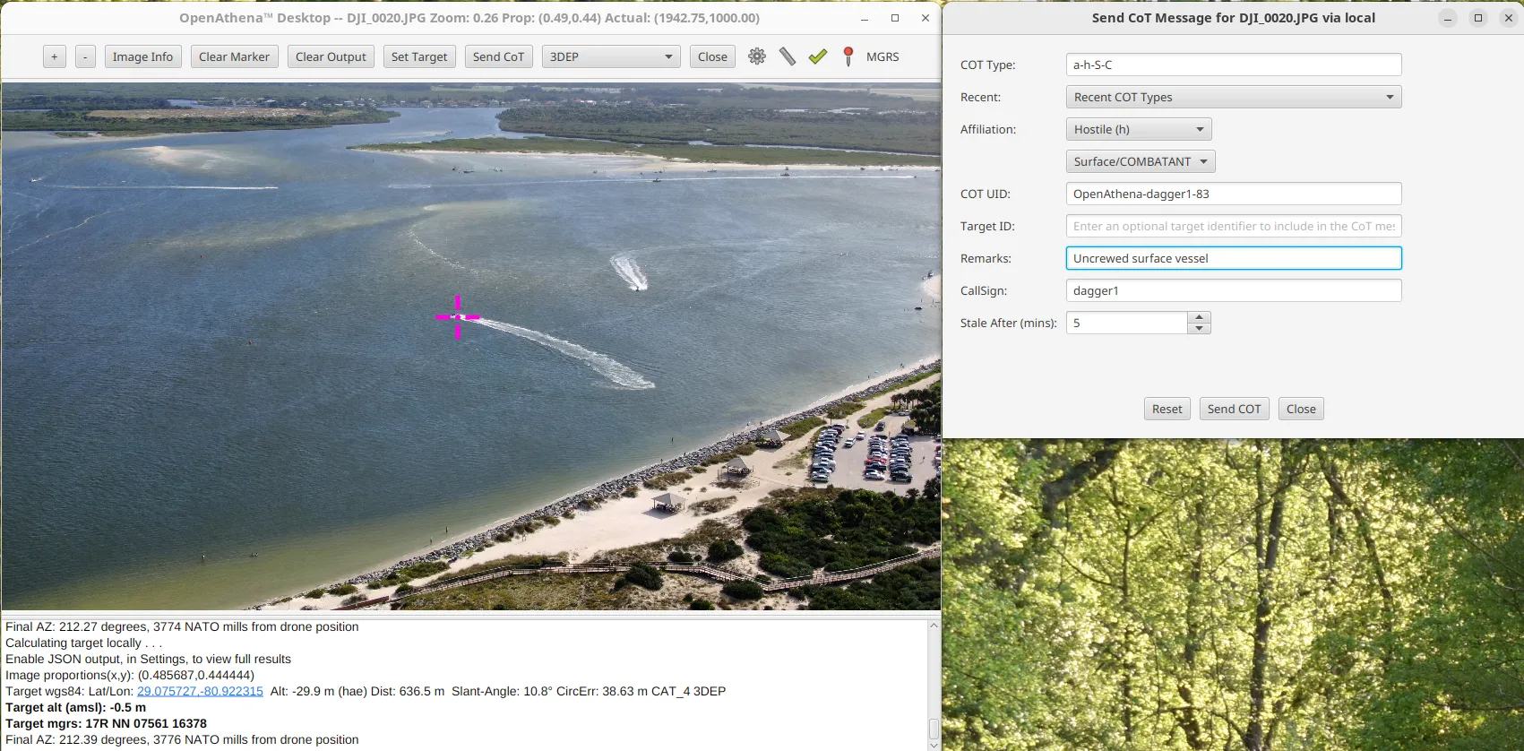
OpenAthena Desktop U.S. and OpenAthena Desktop CIV share the same fundamental terrain-raycast, terrain-management, coordinate-conversion, export, and networking capabilities. The primary distinction between them is the collection of Cursor on Target (CoT) entity types available for selection when an operator sends position-location information from OpenAthena Desktop to Team Awareness Kit (TAK) software (which is used widely by both civilian first responders and the DoD/DoW for common operating picture on a shared Google Maps-like interface).
OpenAthena Desktop U.S. includes the full supported collection of civilian, dual-use, and military-specific CoT entity types. Theta authorizes this edition only for purchase, access, use, storage, and transport within the United States by eligible U.S. Persons. It may not be provided to a foreign person or taken outside the United States, including through international travel, foreign remote access, or storage on systems outside the United States.
OpenAthena Desktop CIV includes civilian and dual-use CoT entity types, such as person, vehicle, boat, etc., but excludes military-specific entity types. Theta recommends CIV for most commercial, public-safety, environmental, research, and other civilian customers. It may be made available to eligible customers in the United States and abroad, subject to applicable law, restricted-party screening, and Theta’s prohibition on foreign military end users and military end uses outside the United States.
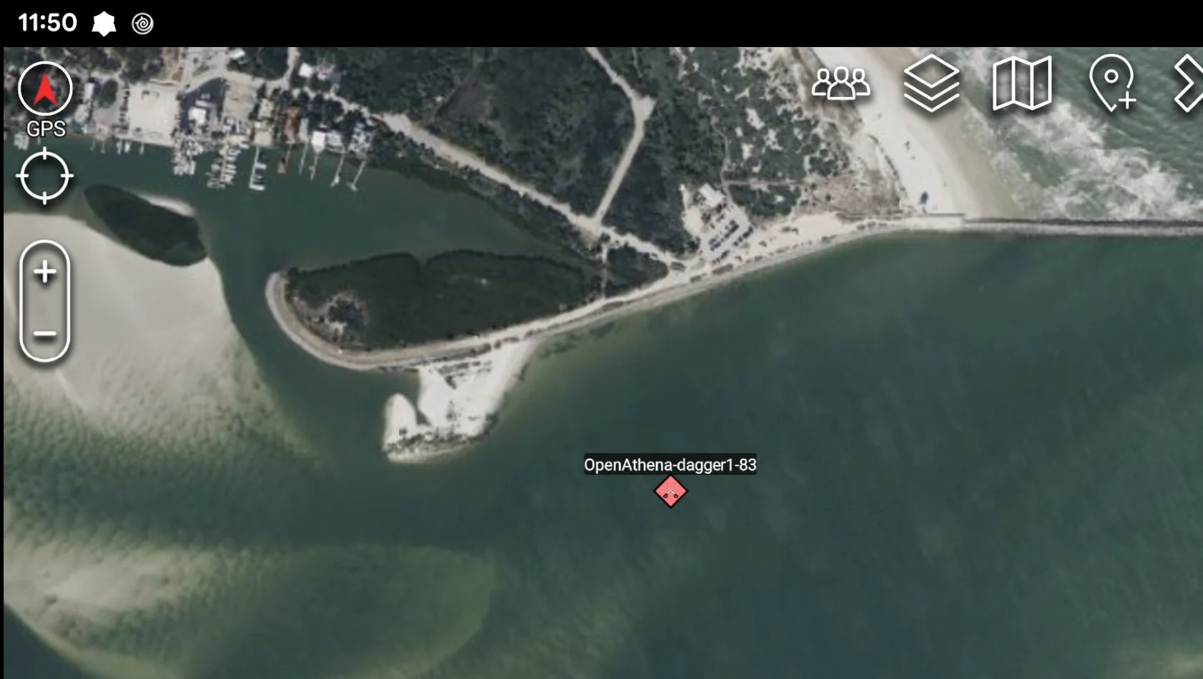
These product distinctions and contractual restrictions are part of Theta’s export-compliance and risk-management process. They do not themselves constitute a governmental commodity-jurisdiction determination, Export Control Classification Number, or export authorization. Customers remain responsible for following the applicable product license and all relevant U.S. export-control and sanctions requirements.
OpenAthena Desktop for Operators; OpenAthena Core for OEMs
OpenAthena Desktop is the operator-facing graphical application within the broader OpenAthena product family. It is powered internally by the same OpenAthena Core terrain-raycast engine that Theta offers separately to drone original equipment manufacturers (OEMs), software developers, system integrators, and ground-control-station providers.
For organizations seeking to embed OpenAthena directly into a drone, ground-control station, command-and-control system, or other software product, OpenAthena Core is available as an offline-capable local software module or through Theta’s developer API hosted at https://api.openathena.com. Core provides a RESTful interface, command-line tools, and Java bindings intended for OEM and developer integration. It can operate at the edge onboard a drone or ground station and has previously been integrated with software and robotics frameworks including MAVLink, MAVProxy, ROS 2, PX4, and ArduPilot.
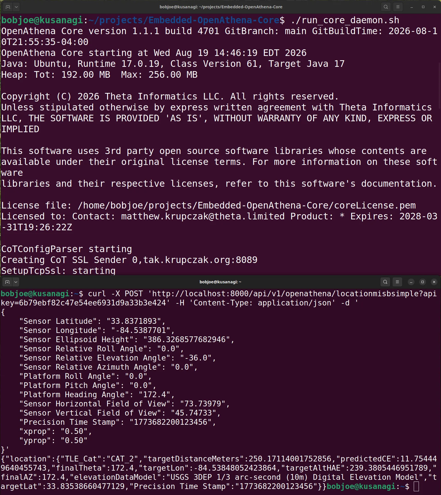
Commercial UAV Expo attendees interested in either the operator-ready Desktop CIV application or a deeper OEM integration can meet directly with Theta’s team at Booth # 1133.
Bringing Advanced Geolocation to More Drone Operators
“OpenAthena began with a straightforward objective: give ordinary drones a capability that would otherwise require specialized sensor hardware, lengthy processing, or substantial integration work,” said Matthew Krupczak, President of Theta Informatics LLC. “With the retail release of OpenAthena Desktop, we are putting that capability directly into the hands of drone-service providers, public-safety teams, land managers, researchers, and other professionals who need to turn a drone image into useful location information quickly.”
Mr. Krupczak added, “Commercial UAV Expo is the right venue for this debut because it brings together the operators who use drone data, the manufacturers who build the aircraft, and the software companies creating the next generation of UAS capabilities. We look forward to demonstrating what OpenAthena can do with the drones many attendees already own.”
Commercial UAV Expo 2026 is expected to bring together more than 3,700 professionals and more than 240 exhibitors from across the United States and international commercial UAS community. The conference and exhibition focus on the practical integration and operation of commercial drone technology across public safety, surveying and mapping, infrastructure, energy, construction, security, agriculture, and other markets.
Retail Ordering and License Provisioning
Attendees will be able to begin the retail purchase process with Theta at Booth # 1133. Each edition is offered at a show and launch week exclusive price $99 per annual license, subject to the applicable order and retail software license agreement.
To support compliance with U.S. export-control and sanctions requirements, final delivery is contingent upon the purchaser providing the required customer, end-user, end-use, and destination information; completion of Theta’s compliance review; and acceptance of the OpenAthena Desktop Retail Software License Agreement. Theta will refund transactions that cannot be completed.
Customers should select the edition appropriate to their eligibility, operating location, and intended use:
- OpenAthena Desktop CIV is recommended for most commercial, civilian public-safety, environmental, research, inspection, and drone-services customers.
- OpenAthena Desktop U.S. is intended for eligible U.S. Persons who require access to the expanded CoT entity-type list and who can comply with its U.S.-only access, use, and transport conditions.
Product and purchasing details are available via the link below:
Other inquiries may be directed to sales@theta.limited. Technical and compatibility questions may be directed to support@theta.limited.
Event Information
Commercial UAV Expo 2026
September 1–3, 2026
Caesars Forum
Las Vegas, Nevada
Theta Informatics — Booth #1133
About Theta Informatics LLC
Theta Informatics LLC is an Atlanta, Georgia-based technology company developing software for drone-enabled remote sensing, geolocation, and target localization. Its OpenAthena product family uses terrain-raycast technology to transform drone imagery and telemetry into ground-location information instantly without requiring a dedicated laser rangefinder.
Theta’s products include OpenAthena Desktop U.S. and CIV for professional operators, OpenAthena Core for drone OEMs and software integrators, a cloud-hosted developer API (https://api.openathena.com), and mobile OpenAthena applications for Android and iOS.
Media Contact
Theta Informatics LLC
info@theta.limited
Sales and Product Inquiries
sales@theta.limited